The Rheocable
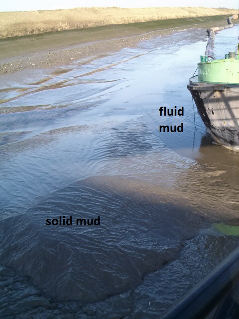
Fluid mud
Many ports in the world
are suffering from the effects of fluid mud. Fluid mud is generated in
areas where fresh water meets salt water. The
result is the formation of a fluid mud layer where flocculation
processes are taking place. Fluid mud is a low viscosity layer that
changes in time and moves with tide and currents. The fluid mud layer
is navigable but generates a number of problems with significant
economical consequences.
Failure of echosounder and density measurements
 The
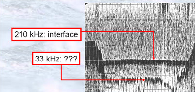
main problem is caused by the fact that echosounders are not
capable of measuring the nautical depth in the presence of fluid mud.
High echosounder frequencies (210 kHz) are reflected on top of the
fluid mud layer and the low frequencies reflections (15 kHz, 33
kHz) are unstable, inconsistent and usually show depth levels
well below the true nautical depth.
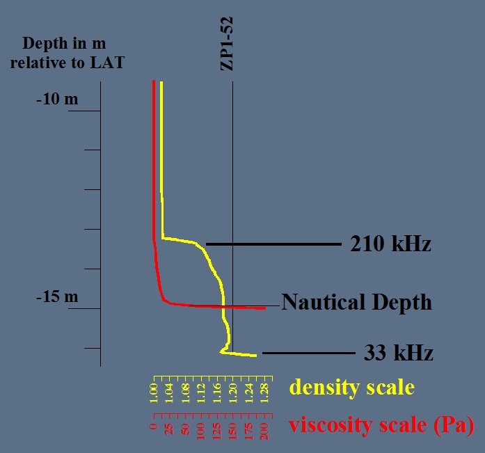
Density based measurements fail just
as well as echosounders in reproducing realistic nautical
depth levels. The reason for these failures is that the nautical depth
defined as the transition from fluid to solid mud does not represent a
clear discontinuity for the density parameter. Only viscosity based
methods are known to be successful in measuring the transition from low
viscosity fluid mud to high viscosity solid mud.
Worldwide applied nautical depth
measurement methodologies using
combinations of echosounder results with density probes are notoriously
inconsistent and inaccurate.
Practical consequences
The fact that nautical depths are poorly
defined has several negative economical consequences for ports trying
to cope with fluid mud.
1. The first problem is the unability to optimise dredge costs. Poorly
known nautical depth levels do not allow port officials to decide when
to start a new dredging campaign and to estimate dredge volumes. As
a consequence dredge costs and mud dumping costs generally are
significantly higher than they should be, because large volumes of
fluid mud are unnecesarily dredged.
2. Poorly defined nautical depth levels can generate contractual issues
between port and dredging contractor. Cases are known involving poorly
defined nautical depth levels being higher after the dredging campaign
as compared to the situation before dredging!
3. Severe economical consequences may be caused by shipping companies loosing their confidence in the port due to poor quality bathymetric maps supplied by the port authorities. If shipping companies would decide to avoid sailing through fluid mud, many ports would see their port traffic significantly reduced and some even would have to close down.
3. Severe economical consequences may be caused by shipping companies loosing their confidence in the port due to poor quality bathymetric maps supplied by the port authorities. If shipping companies would decide to avoid sailing through fluid mud, many ports would see their port traffic significantly reduced and some even would have to close down.
Solution: the Rheocable
 The
rheocable method was developed by Demco NV and MDCE bvba to
fullfill the need for a viscosity based continuous bathymetric method
capable of handling fluid mud.
The
rheocable method was developed by Demco NV and MDCE bvba to
fullfill the need for a viscosity based continuous bathymetric method
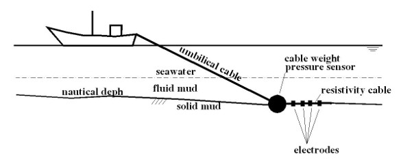
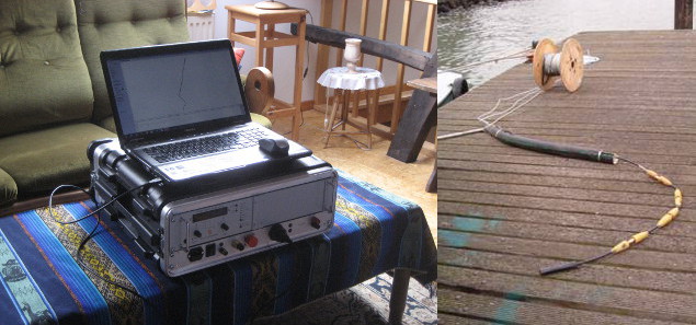
capable of handling fluid mud.A lead weight is towed over the
seabed behind a survey vessel. Next to
the lead weight a pressure sensor is attached to the same towing cable
with a short resistivity cable trailing behind it. The resistivity
cable serves the purpose of verifying that the pressure sensor is
situated on the solid/fluid mud interface. If the cable is located on
the solid mud layer solid mud resistivity values are measured. If the
cable is floating above the solid/fluid mud interface fluid mud and/or
seawater resistivity values are measured.
 If
the survey vessel stops the lead weight slowly sinks into the solid
mud. However, if the boat moves, the high viscosity of the solid mud
generates significant drag forces on the weight resulting in the
weighted pressure sensor being pulled out of the solid mud. The heavy
lead weight ensures the weighted pressure sensor remains on top of the
solid mud as soon as the device leaves the high viscosity solid mud.
The resistivity cable results are used to verify if the cable indeed
remains on the seabed (depending on survey velocity and umbilical cable
length).
The pressure sensor is placed in a sealed pressure pod with 2
circulation tubes reaching above the fluid mud layer to ensure the a
correct translation of pressure measurements into water depths based on
the known density of seawater. The water density is continously
measured using CTD probes (C: Conductivity, T: Temperature, D: Depth).
A thick rubber sleeve is used to protect and streamline the cable weight and pressure sensor.
The Rheocable method is a very practical and effective method to quickly and accurately map an entire port without the need for slow and discontinuous probe measurements. While the survey launch keeps going depth measurements are obtained every second, similar to a normal echosounder survey.
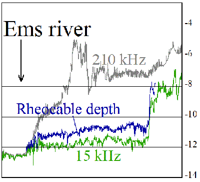 Rheocable
Survey Results - Port of Emden, Germany
|
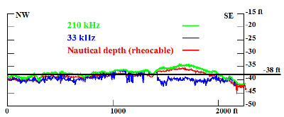 Rheocable Results in the Port of Wilmington, Delaware 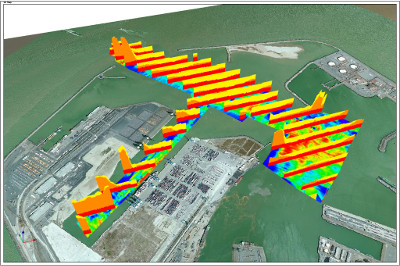 Zeebrugge
Rheocable Results - 3D view
|
Rheocable systems are commercially offered for sale by THV Nautic
(see contact details).
The system comes with acquisition
software graphically showing the ship's position, rheocable depth, high
and low frequency depths and measured resistivity value. Processing
software is included as well as a short personalised training session.
More in-depth information about the Rheocable can be downloaded here.

